Introduction:
The purpose of this activity was to build a scale surface terrain model and use techniques we devise to survey the model obtaining x,y and z(elevation) coordinates. The model was built using a planter box located in the courtyard of the Phillips Science Hall at the University of Wisconsin Eau Claire; in Eau Claire, Wisconsin.
Methods:

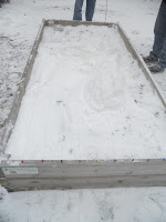
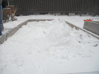
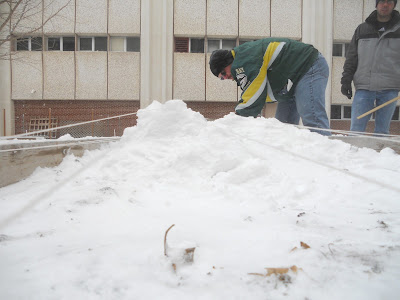
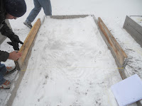
 The planter box was approximately 1.2 meters wide by 2.4 meters long. The depth from the top edge of the box to the soil level was approximately 10 centimeters. Due to the frozen nature of the soil the model was constructed with snow. To create the model the snow was scraped from a large portion of one end of the box to reveal a large flat area. the snow was used in creating a sizable formation in the center of the box which was shaped into hills and ridges. Near the other end of the box we simulated a plateau with a gorge cutting through it. After construction of the terrain we determined the South-West corner to be the origin. We used a ten centimeter grid pattern to measure the elevation points. From the origin we measured across the north and south ends of the box inserting a pin every ten centimeters. We used these pins to layout parallel strings across the length of the box. The parallels ran up and over the terrain. To counteract the elevation of the terrain exceeding the box we used available lumber to effectively increase the height of the east and west sides of the box by fifteen centimeters. We marked these at ten centimeter intervals, pinned a string across the box on the top of the boards and moved them down the length of the box measuring elevation of the of the terrain at the intersection of the cross string and the parallels from the cross string height down to the terrain. After entering the data into excel I subtracted each of the elevation values from the largest value present (the deepest point in the model) to gain a working set of positive elevation values.
Discussion:
 One of the challenges of this project was overcoming the height of the terrain in the box. The parallels could be run in the north-south direction right over the terrain; but when we attempted to run the east-west string the change in elevation would push the string down the hill not giving us an accurate grid. The use of the boards to increase the height of the east and west sides of the box allowed us to clear the model with an accurate grid pattern. Running the parallels was not a necessity, however it sped up the process. By investing a little more time up front to save a lot of time in the end.
 Conclusion:
We built a scale terrain model and effectively gathered the data we needed from it for later use. This exercise forced us to think on the fly and adapt to the situations presented to us. The critical thinking used on this project can be carried forward to other situations encountered in the field.
No comments:
Post a Comment